
Syracuse’s First Annual Open Data Day @ The Onondaga County Public Library
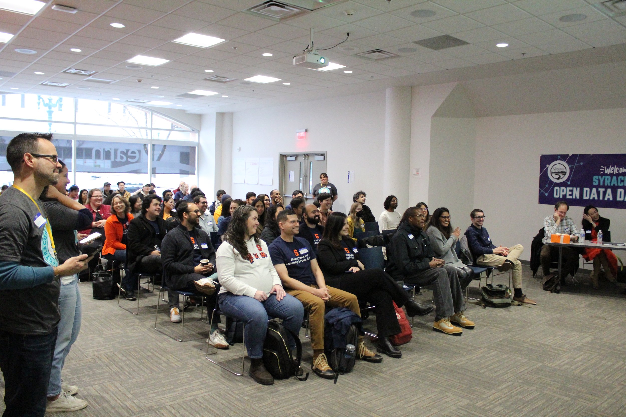
Syracuse held its first Open Data Day on Saturday November 4th at the Onondaga County Public Library in Downtown Syracuse. Over 100 participants came together to celebrate civic open data, attend educational sessions (on topics ranging from how to use Tableau to the synergy between urbanism, AR and open data portals) and engage in a hackathon focused on transportation data.
Open Data is important to the City of Syracuse because it raises the standard of data quality, transparency and accessibility while encouraging our talented community members to provide us with creative insights through channels like Open Data Day and our Office’s regular Open Data Challenges. Opening up civic data encourages departments to look at the quality of the information they track and constantly work to improve this standard. It also allows the city to utilize the collective insights and innovation from many of our talented community members.
The turnout exceeded our wildest expectations. It was rewarding to see so many community members who are passionate about using city data to drive innovation. We welcomed students from Syracuse University’s Maxwell School of Citizenship & Public Affairs, SU’s School of Information Studies (iSchool), Le Moyne College’s Madden School of Business, as well as local professionals and community members.
The breakout sessions were engaging and well attended. A feedback survey completed at the end of the event found that 100% of the people that responded learned something new that day. Also 100% of respondents reported that they found the breakout sessions either quite informative or wonderful.
Break-out Sessions.
Speakers for the event included Amanda Darcangelo and Ashley Gingelewski of Salt City Data analytics who presented on how you can use your own data from your applications, including financial statements and health tracking apps to do your own analysis and visualizations.
Scott Stanton, GIS Professional with Ramboll, led the group on making a map with ArcGIS Online using open data.
Dilpreet Sing Arora presented on how he made a data dashboard using publicly available comments for potential surveillance technologies using Tableau and sentiment analysis.
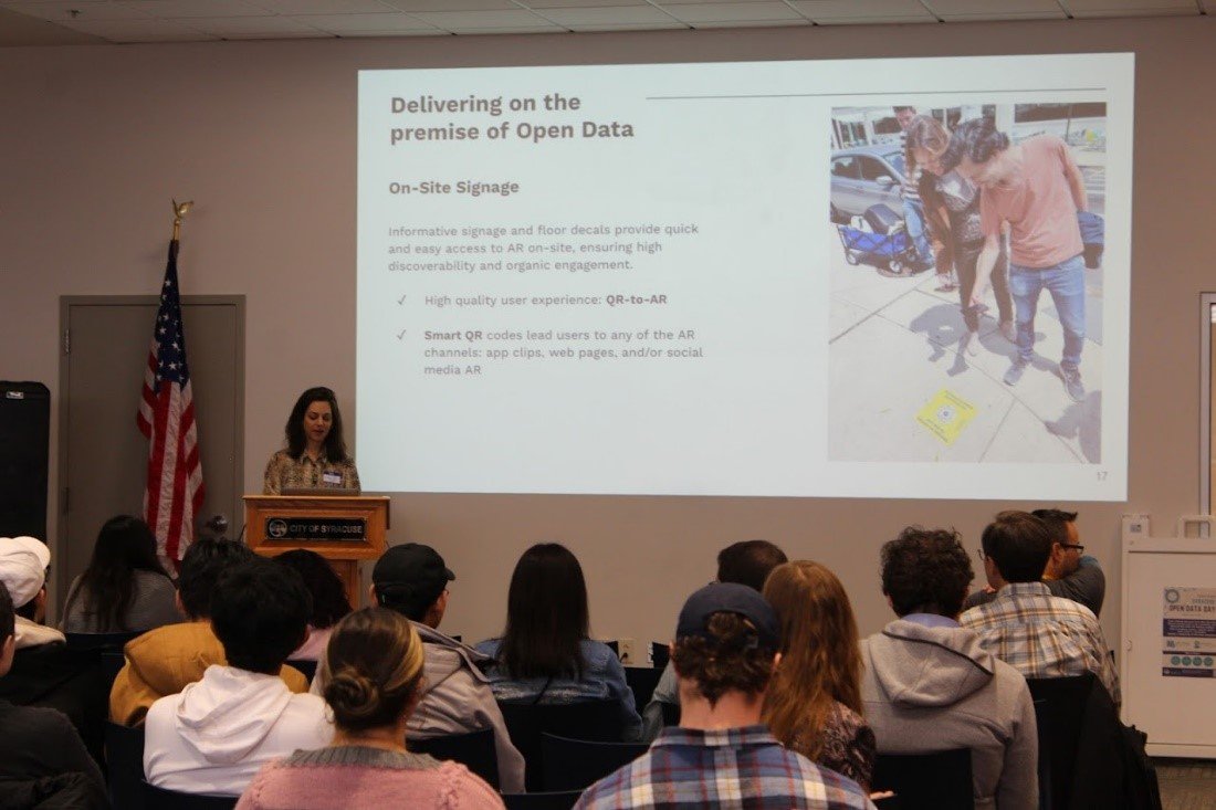
Dana Chermesh-Rechef, Founder & CEO of inCitu led a presentation on Democratizing City Planning through on-site Augmented Reality: the use of AR in engaging residents in the process of urban change. Dana described how their technology uses 3d Models from developers as well as Permit open data from cities to help create or modify the 3d models so that they can display on phones using built-in augmented reality capabilities. This allows community members to visualize how the proposed building will look in the actual location that the building is proposed to be built.
Nicholas Johnson, Founder and Lead Data Scientist/Analyst at Ataviz Consulting led a presentation on how he created his Visualizing Syracuse Public Art Data with Tableau Software.
Prof. Mike Fudge, Program Director at SU's School of Information Studies (iSchool) did a breakout session on using Open Data with Python.
For the afternoon sessions, Andrew Frasier, Transportation Analyst at Syracuse Metropolitan Transportation Council (SMTC), led a presentation on Open Data Options in Transportation.
Mark King, Data Consultant & Project Consultant for the Central New York Community Foundation led a session on visualizing 3rd Grade ELA Readiness data with Flourish.
Jason Scharf, Data Program Manager with the City of Syracuse API team led an overview session on Syracuse’s Open Data Portal, some of the information that is on the portal, and different ways that this information can be accessed.
Many of the presentations from the event can be viewed HERE.
a presentation on Democratizing City Planning through on-site Augmented Reality: the use of AR in engaging residents in the process of urban change.
Hackathon
The event also included a data-focused hackathon. During a hackathon, participants will be given a set amount of time to create an analysis, presentation, or digital project. They will then present their project in front of a panel of judges and compete for prizes.
Our hackathon’s theme was transportation, and teams were given a list of different potential datasets and Application Programming Interfaces (API’s) that they could use to build their projects. Teams were also required to use at least one dataset from Syracuse’s open data portal. Our judges for this year’s event were Nicolas Diaz (Chief Innovation & Data Officer for the City of Syracuse), Mark King (Data Consultant & Project Consultant for the Central New York Community Foundation), and Professor Michiko Ueda-Ballmer (Associate Professor, SU’s Department of Public Administration and International Affairs).
3rd Place
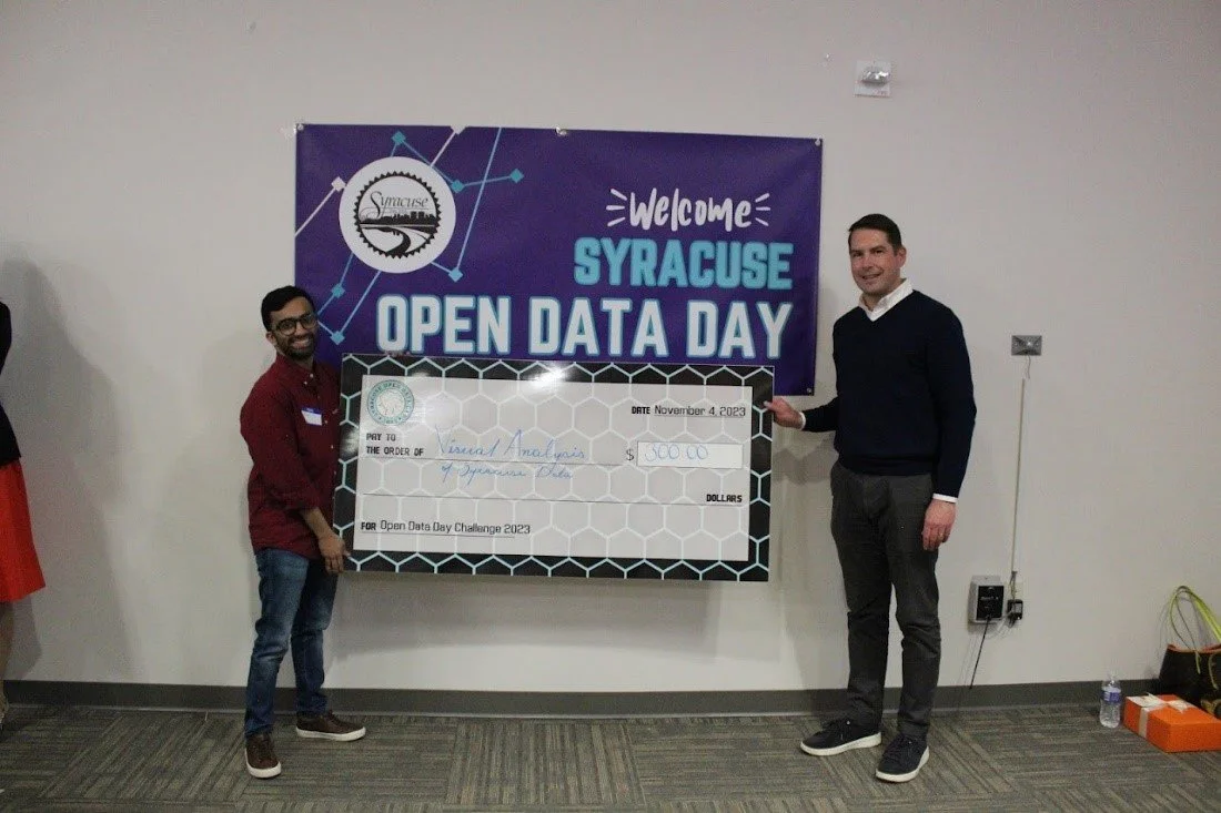
Third place went to Mohit Vellanki for his Visual Analysis of Syracuse Data project. Here Mohit explored information available from data.syr.gov as well as motor vehicle crash case information that he obtained from New York State’s Open Data Portal.
Mohit first worked to break down different requests and submitted through the SyrCityLine app, including what the average hours to close a referral was for different types of requests.
He filtered this data down to Syracuse, NY and explored the relation of the weather on car accidents, explored the information by the day of the week and the time of day. He also highlighted specific crash information regarding crashes involving pedestrians and bicycles.
We received some other great project submission which can be viewed in the project gallery.
2nd Place
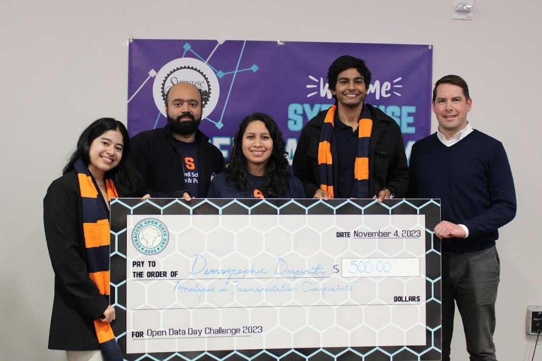
Second place went to Kimberly Ojeda, Haris Khan, Omer Keles, and Josephine Galdamez for Demographic Disparity Analysis in Transportation Complaints. For their project they analyzed information that the city has regarding community member service requests made to SyrCityline through the SeeClickFix application.
After doing some initial analysis of the data, they wanted to focus on how long it takes city departments to respond to requests, and if any of the trends are geographically inclined and correlate with existing inequality.
To help determine this, they mapped the locations of potholes, as reported to SyrCityLine, with the percentage of people of color.
1st Place
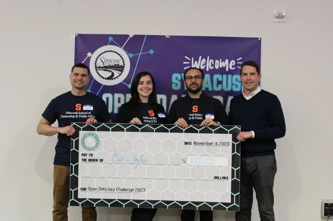
First place went to Ryan Lamson, Akarsh Bhutani, Liam Hannah, and Debora Peci for Bike Infra. They built this project to highlight the urgency in building a comprehensive bike infrastructure for the city of Syracuse. For this project they were inspired by witnessing and experiencing several near accidents on Euclid Ave, which is heavily trafficked at intervals throughout the day with pedestrian, micro mobility, and varying vehicle classes.
Datasets used: They used the datasets from census tracts, Syracuse bike infrastructure, SMTC Bike Suitability of Greater Syracuse, and street light complaints filed by the residents of Syracuse.
Looking forward to 2024
We have been receiving great feedback from the event and we plan to hold another event in the Fall of 2024.
We are looking to connect with individuals and companies/organizations for the following areas:
Break-out session presenters
Members of an advisory group to help develop programming and promote the event
Sponsors (local companies and organizations that would like to help sponsor this event)
Individual volunteers (people that would like to help run our next event)
If you are interested in any of the above areas, please reach out to our team at opendata@syrgov.net to let us know!